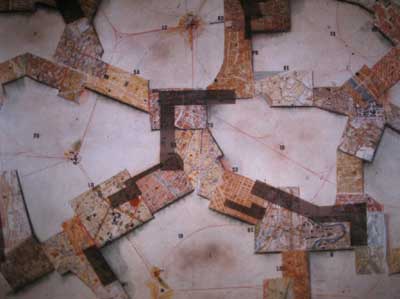
This picture is called "Symbolic Representation of
New Babylon", and it actually is. You see the metastructure pretty
well, because it's a collage of maps of different cities, that are put
together and mix up with each other.
This links very good to the actuality of the whole N.B. - concept: What
we see here as a "symbolic representation" we have today somehow
as a reality. Places that are very remote from each other, with thousands
of kilometers between them are linked up very close through different
kind of social, poltical or technological networks. Some parts of New
York are somehow closer to the centers of Paris, London or Berlin, than
to its own suburbs, because of information technologies, the diversification
and fragmentation of social space or simply new forms of mobility.
This is a reason why the N.B. was re-discovered in architecture theory
only some years ago. It's so much a cyber-architecture avant la lettre
and it anticipated somehow the possibilities of new technologies both
in planning and constructions as in information architecture.